

GPS Tracker - Mobile Tracking app for iPhone and iPad
Developer: Edvin Zacharevic
First release : 26 Sep 2015
App size: 42.67 Mb
With GPS Tracker application you can transform your iOS device to GPS device and use all of GPS-server.net features. In order to use this application, you must have personal account, hosted software or server software.
NOTE: Continued use of GPS Tracker running in the background can dramatically decrease battery life. If you want better battery life, set tracking interval to at least 60-120 seconds.
This application may be useful for:
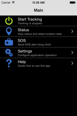
- Tracking your phone online in real time;
- Record and review tracks;
- Recover lost phones;
- Personal safety;
- Keep track of your teenager;
- Save money for business owners.
GPS Tracker features:
- Application gets location using GPS and AGPS;
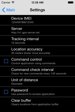
- Possibility to change tracking interval;
- Possibility to change location accuracy settings;
- Battery level percentage is sent together with every location;
- If Internet is lost, application will save locations and upload them later;
- Possibility to control application via web browser using commands;
- SOS long click button;
- Password protection;
- Application runs in background.
GPS-server.net features:
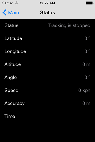
- In real-time tracking mode you will see your current location on the map, or the last position when your GPS device connection was active.
- Server can generate and send you notifications via e-mail or notify with a pop-up window, when something happens. That kind of events might be when object enters or exits geofence area, violates speed limit, presses SOS button, GPS device loses connection and even starts engine or opens door.
- With geofences you are able to make a virtual perimeter on geographic areas that have specific interest for you. The main reason to have Geofences is to control whether the units stays within it or not, so that when the geofencing unit enters or exits the area a notification is generated.
- POI (Points of Interest) allow you to put markers at the locations that might be interesting or useful. You can also name the place, add short description, attach an image or even video to it.
- The history of your tracks can be put on the map with addition information, such as time/speed graph, stops, reports, etc. There is also possibility to generate group reports for your objects.
- You can search for addresses from the search panel, enter point coordinates. Also you can use tools for calculating distances between places on the map and etc.
- Possibility to manage GPS devices on your own, add extra sensors. Customizable user settings.
- Mobile version of tracking application, which is designed to run on mobile devices.